Airline Weather
Industry Solutions
Explore real-world use cases and solutions tailored to each industry's unique weather challenges.

Construction Weather

Logistics Weather

Facility & Plant Weather

Municipal Weather

Retail Weather

Energy Weather

Dam Weather

Insurance Weather

Agricultural Weather

School Weather

Event Weather

Sports Weather

Road Weather

Railway Weather

Climate Tech

Broadcasting Weather

Coastal Weather

Airline Weather

General Aviation Weather

Drone Weather
Weather Solutions
Industry Solutions
Top PageWeather Solutions
Potential Formation of a New Tropical Cyclone — Outlook Based on Conditions Near Guam, MJO Activity, and ENSO Trends
April 7, 2026 Weathernews
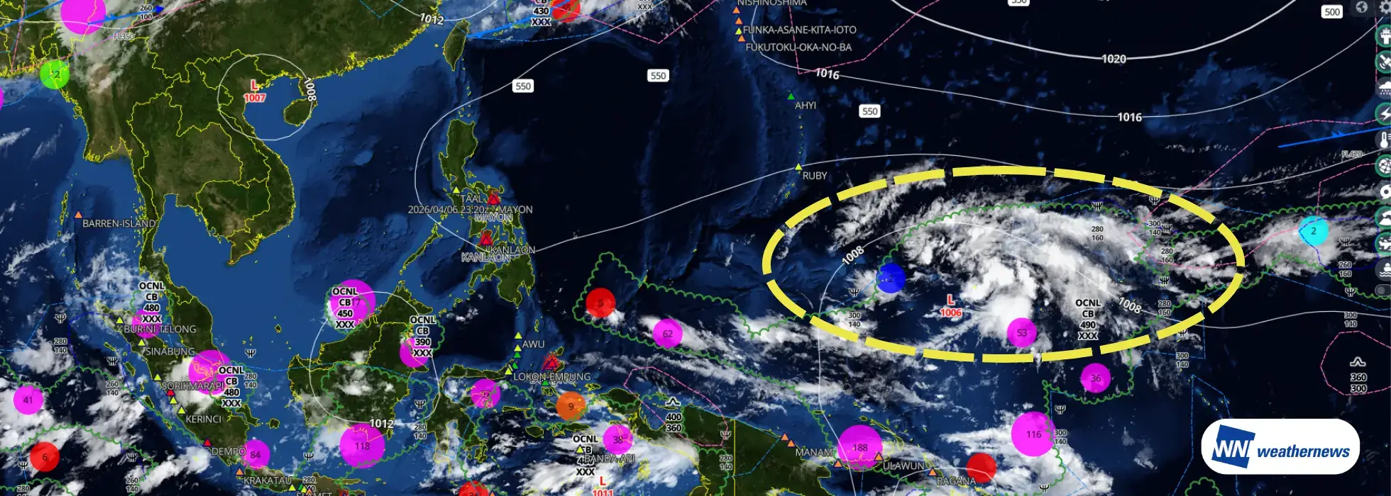
A tropical disturbance near Guam in the western Pacific is showing signs of consolidation, raising the possibility that it may develop into a tropical cyclone.
At present, the active phase of the Madden–Julian Oscillation (MJO) has entered the western Pacific. This pattern is creating an environment favorable for tropical cyclone formation not only in the western Pacific but also across parts of the South Pacific. In addition, the recent evolution of the El Niño–Southern Oscillation (ENSO) is exhibiting characteristics similar to years in which multiple tropical cyclones formed in succession.
*The tropical disturbance outlook presented in this article represents the independent assessment of Weathernews Inc. (WNI).
In 2026, one tropical cyclone has formed in each of January, February, and March.
According to statistics from the Japan Meteorological Agency (since 1951): ・Tropical cyclones formed in every month from January through April in only three years: 1955, 1965, and 2015. ・Continuous monthly formation beyond April occurred in only two of those years: 1965 and 2015. ・2015 remains the only year since 1951 in which a tropical cyclone formed in every month of the year (in 1965, the sequence ended in November).
If a tropical cyclone forms in April 2026, it would become the fourth case since 1951 in which tropical cyclones occurred in each month from January through April.
From 2024 to 2025, the climate system transitioned from a pronounced El Niño event toward La Niña conditions (or near-La Niña conditions). Looking ahead, the likelihood of El Niño developing again in the summer of 2026 (around June–August) is increasing.
Among the previously mentioned cases of continuous tropical cyclone formation from January through April, the years 1965 and 2015 showed ENSO transition patterns similar to this sequence (strong El Niño → La Niña or near-La Niña conditions → El Niño). The current situation in 2026 exhibits tendencies comparable to those two years.
For reference, the number of tropical cyclones in those years was as follows (Japan Meteorological Agency statistics): ・Total annual formations: 1965 – 32, 2015 – 27 (climatological average: 25.1) — both years were above the long-term average. ・Total during August–October (three months): 1965 – 15, 2015 – 13 (climatological average: 14.1) — activity during the peak season was close to the climatological average.
While the total number of formations throughout the year was relatively high, activity during the peak season (August–October) tended to remain near the climatological average.
Sources:ENSO Forecast: IRI (International Research Institute for Climate and Society, Columbia University)ENSO Historical Data: NOAA (National Oceanic and Atmospheric Administration)
With the active phase of the Madden–Julian Oscillation (MJO) currently positioned over the western Pacific, the disturbance near Guam may develop into a tropical depression and potentially intensify into a tropical cyclone. At present, however, no other signs of new tropical cyclone formation are evident, and this event is expected to remain an isolated occurrence.
This outlook is based on the independent analysis of Weathernews Inc. (WNI). Please continue to monitor the latest weather information for updates on its development and evolving meteorological conditions.
Explore real-world use cases and solutions tailored to each industry's unique weather challenges.
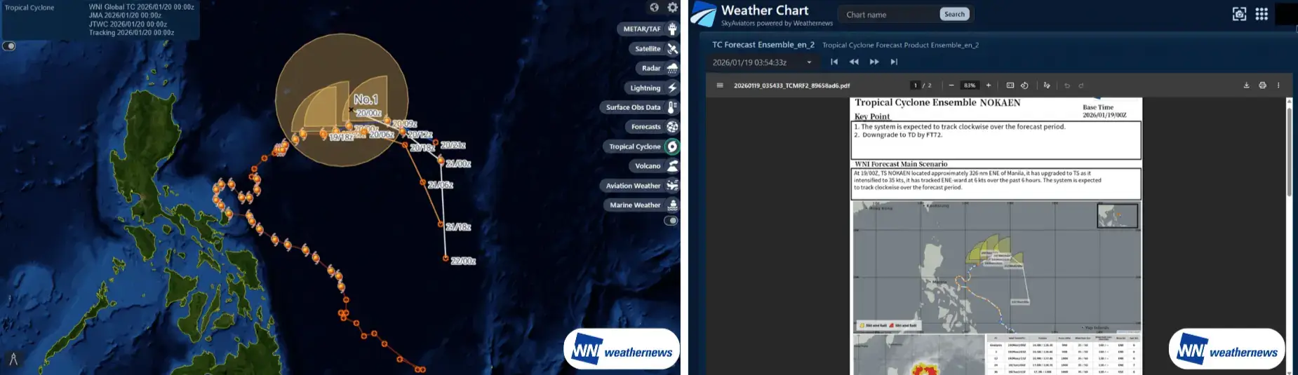
From historical tropical cyclone observations to forecast tracks from multiple agencies, all key information for operational decision-making is unified in a single platform. Impacted airports are automatically identified using threshold settings, with PDF briefings on track confidence and sea surface temperatures provided to improve the speed and accuracy of decisions during the tropical cyclone season.
Past observed tracks, current position, and forecast paths are seamlessly displayed, allowing intuitive understanding of track changes and trends.
Forecast tracks from multiple sources—including WNI proprietary analysis, the Japan Meteorological Agency (JMA), and the Joint Typhoon Warning Center (JTWC)—are shown on a single screen to visualize forecast spread.
Weather layers such as radar, satellite imagery, and lightning data can be overlaid to assess surrounding conditions from multiple perspectives.
Expert-prepared PDF briefings explaining track confidence and meteorological factors are provided, while impacted airports are automatically highlighted based on user-defined thresholds.
Comparing multiple forecasts reveals track variability and potential change risks, improving the quality of decision-making.
Viewing past, current, and future information on a single screen enables earlier action as a tropical cyclone approaches.
Automatic identification of impacted airports reduces manual checks and improves operational efficiency.
Expert briefings help establish a shared understanding across operations teams, field staff, and management.
Please feel free to consult with us about implementation methods, features, or advancing specific considerations. We'll answer even the smallest questions.
We'll explain pricing details and provide specific content based on your site conditions so you can consider with confidence.
Free Quote
We'll explain in detail how to utilize features and the implementation process. Please feel free to consult with us.
Consider Implementation